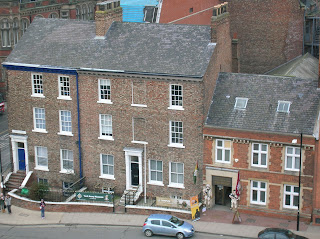
This may be the Last Post for this establishment; I called here yesterday to enjoy a quiet ten minutes and an espresso before a wedding, only to find the place abandoned and a handwritten note attached to the door informing enquirers of its closure. It is apparently one of three such establishments in the vicinity to have folded since the beginning of the year.
Monday, February 28, 2011
Sunday, February 27, 2011
Pretty corner …
with one of the Minster School houses in red, and St William's College in black and white. The Minster itself is only a few paces to the left. Strollers going in this direction are greeted round the corner by a selection of enticing boutiques, cafés and the National Trust shop (here and here). Once again, this is snow from a year ago.
Saturday, February 26, 2011
St Nicholas Fields
St Nicholas Fields nature reserve, just a few minutes' walk from Walmgate Bar, is now a maturing open space, rescued in the late 1980s from an earlier life as a council tip. In its time it has seen a 12th century hospital and church, Civil War fighting and a 19th century brickworks. The latter operated until the 1950s, providing bricks for the construction of Tang Hall estate. Twenty species of butterfly have been recorded here and the reserve also attracts nesting birds, including kingfisher and siskin.
Thursday, February 24, 2011
Flash door on St Saviourgate
Another dreadful play on words to cover the photographic fault: as well as referring to the device on the camera, flash is also an adjective meaning showy, extra-smart or similar.
Wednesday, February 23, 2011
Red Tower 2
Tuesday, February 22, 2011
No cycling
this day on the Sustrans cycle path which runs parallel to our street. This picture was taken over a year ago and shows the road bridge taking Tang Hall Lane over the former Derwent Valley Light Railway line, now the Sustrans cycle path. The remaining half mile of the railway to the east of York has been preserved; go here for pictures from 2004 onwards.
Monday, February 21, 2011
Tall towers, tall chimneys
The central and twin west towers of York Minster are seen here from the north-west section of the city walls which runs parallel to Gillygate.
Friday, February 18, 2011
More of the same …
A typical black and white painted timbered construction on Pavement, opposite Marks and Spencer. The flexion in the lower beam is impressive; the interior doors of these older buildings have to be cut at an odd angle to allow for the slope on the floor, which makes draughtproofing pretty difficult. For another photograph of the same spot showing the Golden Fleece, allegedly the town's most haunted pub, next door, go here.
Thursday, February 17, 2011
The second or third best day out in history
"The best day out in history" is the Castle Museum strapline, and this is the other wing of the building seen from Clifford's Tower, unfortunately a few minutes too late for the bright winter sun we had been enjoying up to this point.
Tuesday, February 15, 2011
Monday, February 14, 2011
Pigs might sail
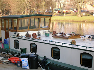
This pretty houseboat is on the River Ouse, just beyond Skeldergate Bridge. For non-native speakers: the exclamation, "Pigs might fly!" is used to express the improbability of something happening. The French equivalent is, "When chickens have teeth!"
Sunday, February 13, 2011
One of the many
The Millenium was a year of pedestrian bridge building; one of the most startling crosses the Tyne between Gateshead and Newcastle. York's version is modest by comparison, but provides a very useful, attractive crossing at this end of town connecting Rowntree Park and Bishopsthorpe Road to Fulford Road and the University.
Saturday, February 12, 2011
Oh buoy!
Half-way between Skeldergate Bridge and the Millenium Bridge, just outside of Rowntree Park, looking over the Ouse to some mock Tudor dwellings. Great that the lifebuoys along this stretch were all in place; not so great that I had to cycle through flood mud to continue my journey.
Friday, February 11, 2011
St Andrew's evangelical
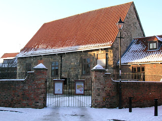
This attractive grade II listed building between St Andrewgate and Spen Lane is home to an active open brethren evangelical congregation. It's tempting to join them in order to have free town centre parking. Go here for an aerial view.
Closed in 1559 by Parliament to reduce the number of city centre churches, the chapel has in its time been a stable, school and house of ill repute. It boasts 15th century timber roof structure and a large window in the perpendicular style.
Thursday, February 10, 2011
Flood light 3
Although this has the added interest of the boat, I prefer this earlier picture because of the light. Thanks to those who commented on the flood photo of a few days ago. I haven't had time to get down to the Ouse to see how much it has overflown this time, but go here to observe how bad it can get.
Wednesday, February 9, 2011
Clifford's Tower 4
Three middle-storey windows seen from inside the more-than-half-ruined tower. There is access to the upper storey where a circular walkway gives panoramic views across the town.
Sunday, February 6, 2011
Flood light 2
An old one of the relatively light River Ouse floods of a few months ago, taken from the right bank looking towards the town centre.
Saturday, February 5, 2011
The best day out in history
The neo-classical frontage of the east wing of the Castle Museum from the top of Clifford's Tower. A few moments earlier it had been bathed in late afternoon sun.
Friday, February 4, 2011
All Saints' lantern 4, York
Unstraightened, but cropped to remove the traffic, here is All Saints, Pavement viewed from the Stonebow upper level car park. Marks and Spencer is on the right with a pub, hat shop, shoe shop, bank and bakers on the left. More on the church, with pictures of the interior here. This is just round the corner from yesterday's Whip-ma-whop-ma-gate post.
Thursday, February 3, 2011
Wednesday, February 2, 2011
Black Swan detail
Tuesday, February 1, 2011
Hidden Hungate
This is the easily-missed St Saviourgate side of Hungate, consisting of only a few linked dwellings on the western side of Stonebow. The eastern side, currently under development will look very different.
Labels:
chimneys,
Hungate,
outdoor art exhibition,
St Saviourgate
Subscribe to:
Posts (Atom)


